Continental Cloud-Optimised GeoTIFF Mosaics
Some Digital Earth Australia (DEA) products are provided as continental-scale mosaics in addition to tile-based datasets.
These datasets are made available as Cloud-Optimised GeoTIFFs (COGs), a format that enables users to efficiently stream raster data directly from the cloud without downloading the files. This provides a fast and convenient way to access full-continental coverage from tools like QGIS or ArcGIS Pro, especially when working with large datasets.
Not all DEA products provide continental-scale COGs. Currently, this access method is only available for selected products:
VRT (Virtual Raster) files are provided alongside the .tif mosaics. These files serve as lightweight wrappers around the main data and can be used to open data in GIS software with visual settings already applied. We use VRTs to provide:
Predefined colour legends for classified products like Land Cover
Band combinations, such as true colour (RGB), for easier visualisation
Accessing COG Mosaics in QGIS
To stream DEA COGs directly in QGIS, follow these steps:
Navigate to the AWS S3 directory for the relevant DEA product: - Land Cover COGs - Intertidal COGs - Tidal Composites COGs - Coastal Ecosystem Map COGs
Choose a specific year (e.g.
2024--P1Y).Right-click on a
.tifor.vrtfile and select Copy link address.In QGIS, there are two options for loading the COG:
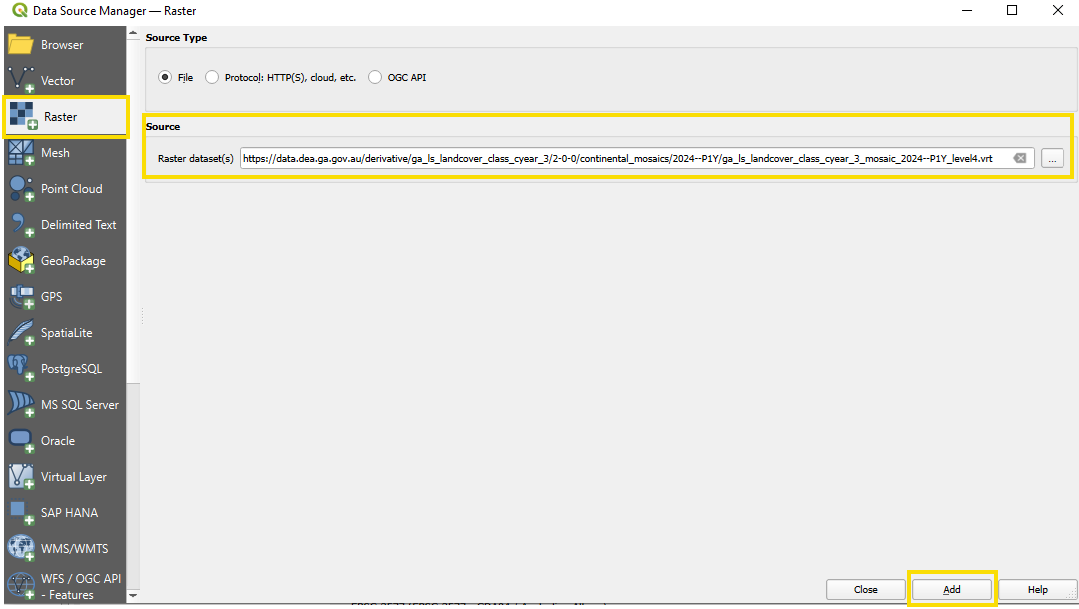
Option 1:
Go to Layer → Add Layer → Add Raster Layer.
Under Source, next to Raster dataset(s), paste the URL you copied.
Click Add.
If prompted with a message asking whether to stream the data, click Yes to avoid downloading the entire file.
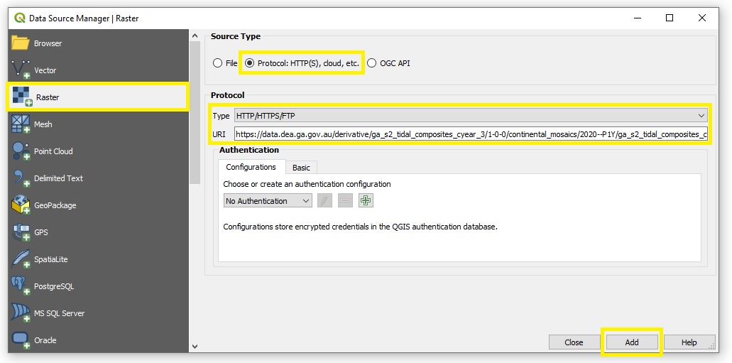
Option 2:
Click Layer → Add Layer → Add Raster Layer.
For Source Type, select Protocol: HTTP(S), cloud, etc.
For Protocol Type, select HTTP/HTTPS/FTP.
In the URI field, paste the copied link.
Click Add to start streaming the layer.
Tip
You can avoid prompting the pop-up by adding /vsicurl/ before the HTTPS URL when specifying the raster source. For example:
/vsicurl/https://data.dea.ga.gov.au/?prefix=derivative/ga_ls_landcover_class_cyear_3/2-0-0/continental_mosaics/2024--P1Y/ga_ls_landcover_class_cyear_3_mosaic_2024--P1Y_level4.vrt
Accessing COG Mosaics in Esri ArcGIS Pro
To connect Esri ArcGIS Pro to DEA’s Amazon S3 bucket, follow Esri’s tutorial: Create a cloud storage connection.
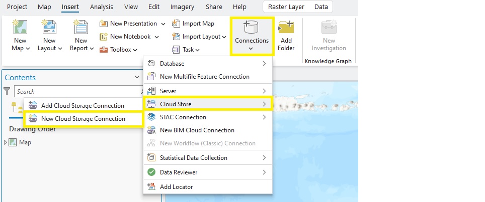
In ArcGIS Pro, click the Insert tab → Connections → Cloud Store → New Cloud Storage Connection.
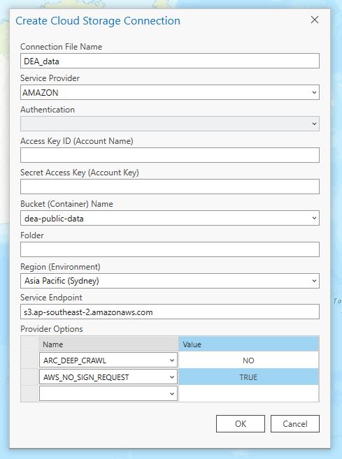
Add the following details to the Create Cloud Storage Connection dialog box:
Connection File Name —
DEA_dataService Provider —
AMAZONBucket Name (Container) —
dea-public-dataRegion (Environment) —
Asia Pacific (Sydney)Service Endpoint —
s3.ap-southeast-2.amazonaws.comProvider Options -
ARC_DEEP_CRAWL—NO-AWS_NO_SIGN_REQUEST—TRUE
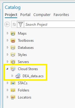
In the Catalog pane:
Expand Cloud Stores.
Expand the DEA_data.acs cloud store.
Navigate to the relevant product folder, e.g.:
derivative/ga_ls_landcover_class_cyear_3/2-0-0/continental_mosaics/orderivative/ga_s2ls_intertidal_cyear_3/2-0-0/continental_mosaics/.Enter a directory of a particular year, e.g.
2018--P1Yor2024--P1Y.Drag and drop the
.tifor.vrtCOG file onto the map (or right-click and select “Add to map”).
Important
When adding COG files to ArcGIS Pro, select No when asked whether to build statistics for the layer.
Note
If you experience any issues accessing or streaming DEA COG files, please contact: earth.observation@ga.gov.au