![]()
DEA Sandbox
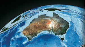
Welcome to the Digital Earth Australia Sandbox. Here you can explore and analyse our data using interactive Jupyter Notebooks and Python tools from the DEA Notebooks repository.
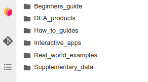
Using the sidebar On the left side of the window you will see a sidebar containing folders. Double-click to open a folder then double-click any ‘.ipynb’ notebook file to view and interact with it. |
Beginners guide Introductory notebooks aimed at introducing Jupyter Notebooks and how to load, plot, and interact with DEA data. Get started with the Introduction to Jupyter Notebooks. |
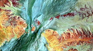
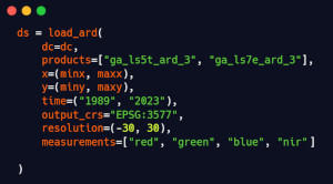
DEA products Notebooks introducing DEA’s satellite datasets and derived products, including how to load each dataset and any special features of the data. You will find guides on our data products such as DEA Coastlines and DEA Waterbodies. |
How-to guides A recipe book of simple code examples demonstrating how to perform common geospatial analysis tasks using DEA and open-source software. There are how-to guides on numerous topics such as pansharpening Landsat data and rasterising and vectorising. |
Interactive apps Interactive apps and widgets that require little or no coding to run. These include tools for exporting satellite images, exporting animations, and analysing decades of coastal change. |
Real world examples More complex case study workflows demonstrating how DEA can be used to address real-world problems. These case studies cover many scientific and management applications from fire mapping to algal bloom detection. |
DEA Tools An open-source Python package containing functions and algorithms to assist in analysing DEA data. It includes tools for loading data, plotting data, spatial analysis, and machine learning. |


Learn more
Visit the DEA Knowledge Hub for comprehensive information about the datasets and concepts used in these Notebooks. The Knowledge Hub contains several sections, including:
Product Metadata |
DEA User Guides |
DEA Tools Python API |
Tech Alerts and Changelog |
Contact us
If you need assistance, please post a question on the Open Data Cube Slack channel or on the GIS Stack Exchange using the open-data-cube tag. But first, check the previously asked questions for if your question has already been answered.
To report a problem with the Jupyter Notebooks or DEA Tools, please create an issue on the GitHub repository.
License: The code in this repository is licensed under the Apache License, Version 2.0. Digital Earth Australia data is licensed under the Creative Commons by Attribution 4.0 license.
Citation: If you use DEA Notebooks material in your work, please reference it with the following citation.
Krause, C., Dunn, B., Bishop-Taylor, R., Adams, C., Burton, C., Alger, M., Chua, S., Phillips, C., Newey, V., Kouzoubov, K., Leith, A., Ayers, D., Hicks, A., DEA Notebooks contributors 2021. Digital Earth Australia notebooks and tools repository. Geoscience Australia, Canberra. https://doi.org/10.26186/145234