GA Multi-scale Topographic Position
GA Multi-scale Topographic Position
multi_scale_topographic_position
- Type:
Raster
- Coverage:
2018
- Produced by:
Geoscience Australia
External data
This data product is produced by an external party and is not a DEA product. DEA provides this data without modifications except where needed to make it compatible with our systems.
About
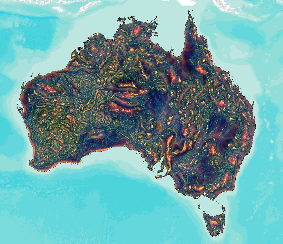
A Multi-scale topographic position image of Australia has been generated by combining a topographic position index and topographic ruggedness. Topographic Position Index (TPI) measures the topographic slope position of landforms. Ruggedness informs on the roughness of the surface and is calculated as the standard deviation of elevations. The derived ternary image captures variations in topographic position across these spatial scales (blue local, green intermediate and red regional) and gives a rich representation of nested landform features that have broad application in understanding geomorphological and hydrological processes and in mapping regolith and soils over the Australian continent.
Access the data
For help accessing the data, see the Access tab.
Go to the external data page
Data Explorer
Access the data on AWS
Key specifications
For more specifications, see the Specifications tab.
Long name |
Geoscience Australia Multi-scale Topographic Position Image of Australia |
Bands |
|
Persistent ID |
|
Licence |
Cite this product
Data citation |
Wilford, J., Sudipta, B., Lindsay, J. 2019. Multi-scale Topographic Position Image of Australia. Geoscience Australia, Canberra.
|
Paper citation |
Lindsay, J, B., Cockburn, J.M.H. and Russell, H.A.J. 2015. An integral image approach to performing multi-scale topographic position analysis, Geomorphology 245, 51-61.
|
Product ID
The Product ID is multi_scale_topographic_position. This ID is used to load data from the Open Data Cube (ODC), for example dc.load(product="multi_scale_topographic_position", ...)
Bands
Bands are distinct layers of data within a product that can be loaded using the Open Data Cube (on the DEA Sandbox or NCI) or DEA’s STAC API.
Type |
Units |
Resolution |
Nodata |
Aliases |
Description |
|
|---|---|---|---|---|---|---|
local |
int16 |
None |
0.000833 degrees |
0 |
None |
Local spatial scale (0.2-8.1 km) |
intermediate |
int16 |
None |
0.000833 degrees |
0 |
None |
Intermediate spatial scale (8.2-65.2 km) |
regional |
int16 |
None |
0.000833 degrees |
0 |
None |
Regional spatial scale (65.6-147.6 km) |
Product information
This metadata provides general information about the product.
Product ID |
multi_scale_topographic_position
|
Used to load data from the Open Data Cube. |
Long name |
Geoscience Australia Multi-scale Topographic Position Image of Australia |
The full name or technical name of the product. |
Producer |
Geoscience Australia |
The external party (outside Digital Earth Australia) that produces this data. |
Spatial type |
Raster |
The most common spatial types are raster and vector. |
Temporal coverage |
2018 |
The time span for which data is available. |
Coordinate Reference System (CRS) |
The method of mapping spatial data to the Earth’s surface. |
|
Catalogue ID |
The Data and Publications catalogue (eCat) ID. |
|
Licence |
The licence and copyright. |
Product categorisation
This metadata describes how the product relates to other products.
Tags |
digital_elevation_model, srtm, multiscale_topographic_position, tpi, external_data |
Access the data
Go to the external data page |
Learn more about the data from the external provider. |
|
Explore data availability |
Learn how to use the DEA Explorer |
|
Get the data online |
Learn how to access the data via AWS |